I've made four winter attempts on Mt. Washington, and summited three times. Although the altitude of 6,280 feet is de minimis, the weather and wind are extreme. Here are some pictures taken over the years.
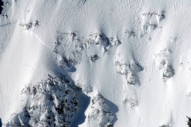
Hillman's Highway, on the southern edge of the entrance to Tuckerman's Ravine.
More of Tuck's
Center headwall of Tuck's
Lion's Head and the Alpine Garden
Up the Summit Pyramid to the top.
At the Mt. Washington Observatory
The summit
Freedom Winter 2010
Thursday, March 10, 2011
Wednesday, February 9, 2011
Transition
After today, Freedom Winter 2010 will be taking on a new mission. I'll be offering advice, reviews, and recommendations on everything related to skiing, climbing, camping, photography, and mountaineering. I'm planning on doing at least three postings a week and considering migrating to an independent website. Upcoming posts include: Tips For First Time Ski Buyers, Cold Weather Layering, and Hiking Mt. Washington In Winter.
Since my last post I have arrived home, taking the Southern Route through the United States. After leaving Denver, I drove south to New Mexico and then headed east driving through Texas, Oklahoma, and Arkansas. From Arkansas I headed south driving along the Mississippi, driving briefly into Louisiana before turning east again, crossing Mississippi, and Alabama. The final leg involved heading north through Georgia and South Carolina before arriving at my temporary lodgings in Raleigh, N.C. In completing the Southern Route, I've now visited 48 states with only Hawaii and Alaska left.
Here's the trip's final photos.
Looks a little worried?
There are only a handful of independent motels left in America. The best ones, visually speaking, still evoke the style of the pre-interstate highway system.
For those fans of No Country For Old Men, you'll recognize this hotel in Las Vegas, New Mexico.
This motel did not survive. Kinda cool to wander around though.
I was waiting for a strung out junkie to leap out of bed. Surprisingly I did not find any evidence of habitation.
The inspiration for Mator, in Radiator Springs fame.
I call this photo The American Economy. Yes, a little trite.
The junk in this image is dust and debris that landed on the camera's CCD sensor. I did not notice it at the time and I don't have the software to remove the dirt. However, Adobe Photoshop Elements is on order, which I can use to fix this image.
Friday, January 21, 2011
Why such a long face?
Sorry, I love that joke.
It's been sometime since the last update. Frankly, much of what I have been doing would not be of terrible interest to my good friends and fans following this blog. Does anyone want to see me in the grocery store? Riding a chair lift? Learning how to ski? I think not.
On top of that, winter in the Northern Rockies offers pretty limited visibility, which often makes for very poor pictures. Contrary to what the advertising shows, it is common for visibility in the mountains to be so limited that driving, skiing and camping and be somewhat unpleasant. It is entirely possible, in fact probable, that in these climes you could spend a week in the Tetons and not even see the Grand Teton. For example, I spent several weeks in Driggs, Idaho visiting some very good friends.
Here's an example of the "white room" as viewed from my friends' house in Driggs.
Admittedly this was a very "low viz" afternoon, but not entirely uncommon. When the clouds do break however, the vistas are amazing.
These two photos were taken within 300 feet of each other, both looking east. No joke. A true blue bird day like this one is extremely rare in this part of the Rockies.
Because my skiing is mediocre at best, I don't bring my camera skiing, instead relying on my much more durable iPhone. Although I don't baby my Nikons by any stretch of the imagination, given my propensity for epic wipe-outs (known as yard-sales in the ski community), it was simply too risky to bring along my expensive camera.
Thankfully, the iPhone does a pretty good job. Here's looking north from the top of Rendezvous Mountain, the highest point at Jackson Hole Mountain Resort.
Here's another iPhone shot at Grand Targhee taken from the top of the Sacagawea lift. The town of Driggs is down in the valley.
People often describe the Tetons as having four ski resorts. First, the internationally famous Jackson Hole. Second, the powder paradise, Grand Targhee. Third, Snow King, a very small, but steep, ski area located at the edge of Jackson. Finally, there is "The Pass" or "Wyoming 22." This resort is not a resort at all, but a series of bowls, glades, and mountains located on the north and south side of Wyoming 22, the route that connects Driggs/Victor, Idaho, to Jackson, Wyoming.
The Pass is not monitored by ski patrol, nor is there any avalanche control in place. Essentially, it is a true backcountry ski experience where you need to rely on your own skills and judgment.
Despite my rookie skier status, I decided to give it a try.
Step 1. Ski, skin, hike, snowshoe up a big hill.
Step 2. Using orienteering skills locate the bowl or glade you want to ski. I choose Edelweiss Bowl, located on the right side of the picture in the distance.
Step 3. Make your way to the top of the bowl and ski down.
Despite my marginal ski skills, I managed to make it down the bowl without crashing. I did have one tense moment however, when I strayed off the established route and found myself on an extremely steep, tree-covered, avalanche prone slab. Needless to say, I did not stop to take my camera out of my backpack and take any photos -- I was too worried that slab would slide and I'd be dead.
Speaking of avalanches, this is what a very big one looks like. It's hard to understand the scale, because this is a cropped iPhone photo taken from a substantial distance. This slide was probably about 200 yards wide and 800 yards from top to bottom and 10 feet deep.
Thankfully this avalanche (or a "slide" to the cognescenti) was triggered by the Colorado Department of Transportation to prevent an even larger slide that could cover Route 6, which crosses Loveland Pass and the Continental Divide.
Speaking of CDOT, I wonder if they have any job openings. I think I may have found the perfect career for me.
I wonder if this is what they use?
Probably not, but for some odd reason this M1 tank was parked on the side of the road just north of Mountain Home, Idaho. And for all your military hardware nuts out there, this is one of the original M1 Abrams. You can tell easily because it has a rifled bore for the older 105 mm main gun. The newer generation M1As have a 120 mm smooth bore gun. Just in case anyone was wondering.
A couple of nights ago, I was looking for a place to camp near Rawlins, Wyoming. I was planning on going to Seminoe State Park, a great park where I spend a couple of nights camping in 1999. The ability of my vehicle to reach the park was in question because of the poor condition of the road. Thankfully, I managed to find a BLM (Bureau of Land Management) campsite on the side of the road. In typical Jared style, I just inflated my pad ground pad, and crawled into my sleeping bag sans tent. During the evening, I was pretty sure I heard some coyotes howling. The next morning, my theory was confirmed.
I only managed to find this fella because I saw this bird picking at it.
On a more serious note, one thing you see in small town America is an intense dedication to our men and women in the Armed Forces, and in particular those fallen. Lt. Looney was from Owings, Maryland but this picture was taken near Fort Collins, CO.
On a particularly foul weather day in Driggs, I decided to make a pilgrimage to Dubois, Wyoming, the burial location of PFC Chance Phelps. I was unable to find the small cemetery and flagged down a county sheriff. When I explained to him I was looking for PFC Phelps, he told me to follow him, and proceeded to lead me through town all the way to Chance's gravesite.
Next to the headstone, a used military ammunition can contained additional offerings left by other visitors and a guest book left by Chance's mom. The tributes in the guest book were deeply moving and have left an indelible mark on me. Regardless of your politics or views on the Iraq War, please take the time to watch Taking Chance. Even the trailer brings me to tears.
I hope everyone is enjoying this blog and photos. I'm working my way back to Virginia now, taking a southerly route through Texas, Oklahoma, Louisiana, Arkansas, Mississippi and Alabama. After visiting those states, only Alaska and Hawaii remain.
I'm planning on doing two more posts for this trip. After I return, I going to scan in some of my slides from previous adventures from all over the United States and Southeast Asia. The pics will cover everything from genocide to rodeos. Until then here are a few photos from my 2005 Euro Bike Trip.
Near Valence, France.
My bike on Mt. Ventoux
Peddling towards Alpe d Huez.
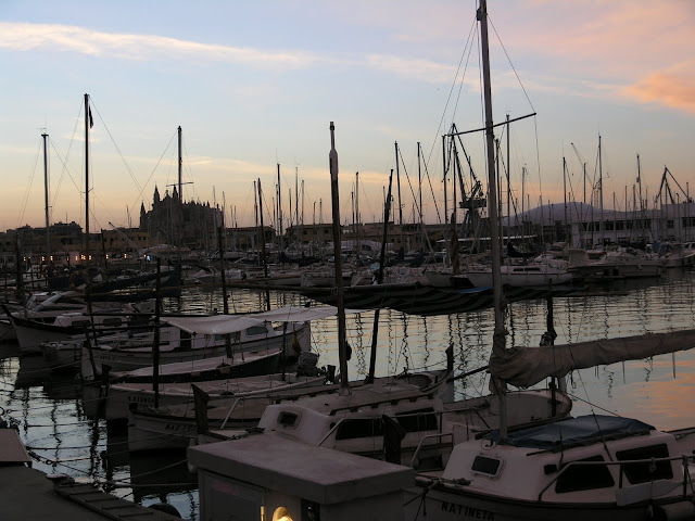
Morning in Palma, Mallorca
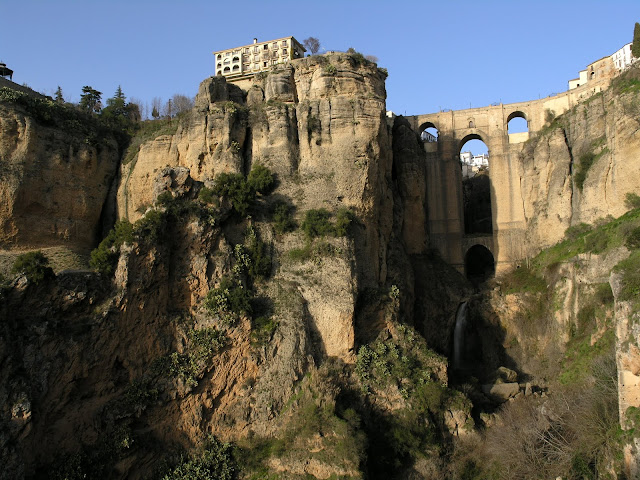
Ronda, Spain
Subscribe to:
Comments (Atom)


