Friday, November 26, 2010

J-Tree Heresy

Joshua Tree, known as "J Tree" in the climbing community, is one of the top climbing destinations in the world.  Entering J Tree long after sunset, I was hoping to awake to soaring cliffs, dotted with multi-pitch climbs of every imaginable difficulty.  Unfortunately, I was greeted with a barren landscape containing what I would consider to be nothing more than grossly oversized boulders.  Wondering where the multi-pitch climbs were, I visited the local climbing shop only to discover that there were not any such climbs in the park.

After picking up my friend Emil at the airport, we did a quick tour of the park and started our climbing adventure at Trashcan Rock.  We did a couple short climbs, and came away unimpressed with the routes and the overall J Tree experience.  Although the rock was extremely textured and very sticky, J Tree was just not as fun as Seneca Rocks. Being so uninspired, I was not motivated to take that many climbing photos, but here are a couple anyway.

A team rapping off of Intersection Rock at sunset.


A team working on a 5.8 route on the southeast side of Intersection Rock.


One of the famous joshua trees along the trail to Lost Horse Mine.  A few years ago a major fire swept over this area of the park, but this tree was lucky enough to survive.   Amazingly, many hearty grasses have already retured to the area helping to stabilize the soil and prevent mass erosion during the occasional rain storm.


Jumbo Rocks early in the morning.


After leaving J Tree, Emil and I drove across the Mojave National Preserve heading towards Death Valley NP, stopping along the way to take some photos and chat up some of the locals.

I like this photo, taken on the side of the road on someone's front lawn, just outside of Twentynine Palms (Twentynine Stumps, as some Marines would say).


Salt mine just south of Route 66.


Getting closer to DVNP, we came across a city of massive RVs parked in the desert.  I introduced myself to Paul and Brad who were happy to have me photograph their dune buggies.

Paul's buggy -- powered by twin Caddy V8s pushing 800 HP.


Brad's buggy -- recently repainted and repaired after it rolled 6 times in a nasty accident.  Brad proudly showed me his finger that was nearly amputated in the crash. 


Brad and Paul were kind enough to tell us that a few miles up the road there was even a bigger gathering of off-roaders, complete with sand dues hundreds of feet high.  And boy were they not kidding, even though the weekend was just getting underway, there were already hundreds of RVs with thousands more en route.


I fit right in with these OTV enthusiasts.


Our next stop was Death Valley.  Honestly, by this time I was kind of burned out with the desert landscape.  Still, DVNP had some amazing sights.

Some very tough women riding in the hottest and lowest place in the USA.


The scale of DVNP, the largest National Park in the lower-48, is hard to comprehend.  I jokingly said to Emil that Delaware would fit in this basin.  A few moments later an interpretive sign informed us that New Hampshire would fit in the basin.  


Being a lover of snow and trees, it's time for Sequoia National Park and Yosemite.  Look for an update soon, along with some better photos than I was able to produce of the Mojave.  And, we're off....


Sunday, November 21, 2010

No Zionists In Zion (But Plenty of Spaniards)

I spent the night before last in Vegas, but was not willing to pay the hotel $12.99 for the privilege of using in-room internet.  Little high it seems to me, when compared to the free and fast Wi-Fi here in Yucca Valley, CA.  

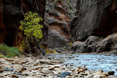
Zion National Park is centered around the Virgin River which created and continues to carve Zion Canyon out of the soft sandstone of southern Utah.  The river is literally the wellspring of life in this part of Utah, with all the flora and fauna depending on its water.  O.K. I'm tyring to hard to sound like John Muri.  Moving on.

ZNP is small but very interesting and I highly recommend it to any travelers, especially those with limited physical abilities.  The Park Service has done and excellent job of making the park accessible by paving the main trails and providing a wealth of interpretative signs.  The trails are paved primarily to prevent erosion, as the desert landscape is very fragile and any disruption of the thin vegetation can lead to a cascade of erosion.   I understand that Zion in the high season can be difficult because of the high temperatures and obscene crowds.   Because of constant traffic jams during the high season, the NPS instituted a mandatory shuttle program.  Free of charge, the NPS operates shuttles in a loop between the Visitors Center and the main sights in the park.  With 2.7 million visitors in 2009, most of them arriving in a 6 month window, ZNP would be an awful experience without this change.  Lucky for me, private vehicles are permitted after November 1, so I was able to make my own schedule.  With the park in "winter" mode there are only a modest number of visitors and no crowds to speak of. 


There is not a statue of Theodor Herzl in ZNP but for some reason, I managed meet a bunch of Spanish tourists.  One couple invited me to their house in Madrid if I am ever in Spain.  Another group I talked to was about to tackel an 8-pitch climb.  Given the geology of the canyon, the climb was probably a very stiff 5.10 c/d, but they were not aiding it.  I hope that made it without incident because the rock in ZNP is very soft to say the least.

When I go to a place like ZNP I avoid taking the stock photos that often find their home in coffee table books and on glossy post cards.  What I do see a lot of in these parks are photographers, with tons of high-end gear, taking these same photos you can find on the internet in a matter of seconds.  Everyone also seems to have a tripod regardless of the photos they are taking.  I'm willing to bet the bulk of these tripod shots were 1/500 sec at f5.6 with a 24mm lens.  Really -- you need a tripod for that.  Of course there are plenty of instances when a tripod is indispensable, but I get the impression that instead of studying the landscape and lighting, a great many shot are missed while people are playing with their Bogen tripod, changing lenses and otherwise not paying attention.  Just my two cents.


This picture is of window in a mile long tunnel that cuts through the canyon wall, enabling access to the eastern enterance to the park.


Look closely ......


Closer...


Water percolating out of the canyon's walls supports a wealth of vegetation.


Finally, some Virgin River photos.  Some of these are "abstract" but I can assure you, they are not staged  or photoshopped.


And, I'll leave you with this last photo.  Look for another update this week from Joshua Tree with climbing action photos.


Tuesday, November 16, 2010

Look Ma -- No Tripod.

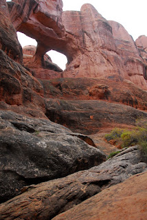
Pictures of Arches National Park.  Commentary to follow . . .


Sunday, November 14, 2010

Eagles On Road

Driving from Dillon, Colorado to Moab, Utah today I saw a sign on side of I-70 warning drivers that "Eagles On Road."  Good advice, because I would feel pretty bad if I ran over an egale, not to mention what would surely be enormous amount of paperwork.  I've actually had a close call before.  Many years ago while driving from Libby, Montana to Spokane, Washington, I came within a few feet of hitting an extremely large blad eagle snacking on roadkill.  It's the closest that I've ever been to a bird of prey in the wild, and I suspect given the predatory instincts of these birds, they learned that a freshly run-over deer is a far easier meal than hunting down a rabbit or similarly unlucky critter.

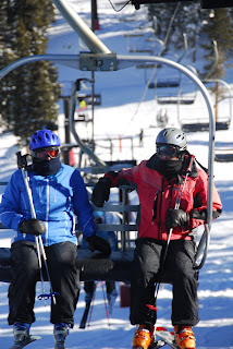
I spent the last three days skiing at Loveland.  Although I always knew I was a poor skier at best, seeing an 8-year old tearing up a difficult run was a very humbling experience.  Since most of these kids have been on skis as soon as they could walk, their extreme skills are not unexpected.  I did not take anywhere near the number of pictures I would have preferred, instead spending most of my time and energy trying to not look like an idiot from sea-level on skis.  Also, because of near constant snow on the second and third days, visibility was limited, marking for far less dramatic pictures.

Right now, I'm in Moab getting ready to spend the next two days in Arches and Canyonlands National Parks.    After that it's onto Bryce and Zion for some additional hiking, followed by a far too long delayed visit to the Grand Canyon.    Given the amazing vistas in Utah and Arizona, plenty of quality photos should follow.

Loveland's ski patrol hut at the top of lift 2.


With all due respect to Colorado skiers, what they consider cold would only be a crisp fall day in Maine or New Hampshire.


Rocking my Coomback skis with Fritschi Freeride bindings.  Great for real powder/backcountry conditions but far too soft on packed groomed trails.  Sweet skis nonetheless, and the Freeride bindings are amazing.


The mighty Colorado River just east of Grand Junction, Colorado.  I wonder if a couple of hunded million years this canyon will resemble the Grand Canyon.


Just a bit further down the road.


Taken at dusk right on the Colorado/Utah border.